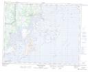
Maps showing Île Verte, Côte-Nord-du-Golfe-du-Saint-Laurent; Basse-Côte-Nord, Quebec
Île Verte is a Island located in Côte-Nord-du-Golfe-du-Saint-Laurent; Basse-Côte-Nord, Quebec.
- Latitude: 50° 39' 33'' North (decimal: 50.6592226)
- Longitude: 59° 11' 48'' West (decimal: -59.1966399)
- Topography Feature Category: Island
- Geographical Feature: Île / Ile
- Canadian Province/Territory: Quebec
- Location: Côte-Nord-du-Golfe-du-Saint-Laurent; Basse-Côte-Nord
- GPS Coordinate Locator Map: Île Verte Lat/Long
Île Verte NTS Map Sheets