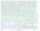
Maps showing Lac Villeneuve, Baie-Johan-Beetz; Minganie, Quebec
Lac Villeneuve is a Lake located in Baie-Johan-Beetz; Minganie, Quebec and has an elevation of 60 meters.
- Latitude: 50° 23' 18'' North (decimal: 50.3884046)
- Longitude: 62° 40' 21'' West (decimal: -62.6726129)
- Topography Feature Category: Lake
- Geographical Feature: Lac
- Canadian Province/Territory: Quebec
- Elevation: 60 meters
- Location: Baie-Johan-Beetz; Minganie
- Atlas of Canada Locator Map: Lac Villeneuve
- GPS Coordinate Locator Map: Lac Villeneuve Lat/Long
Lac Villeneuve NTS Map Sheets