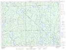
Maps showing Rivière Wabano, La Tuque; Le Haut-Saint-Maurice, Quebec
Rivière Wabano is a River located in La Tuque; Le Haut-Saint-Maurice, Quebec and has an elevation of 402 meters.
- Latitude: 48° 20' 34'' North (decimal: 48.3428409)
- Longitude: 74° 2' 28'' West (decimal: -74.0412296)
- Topography Feature Category: River
- Geographical Feature: Rivière
- Canadian Province/Territory: Quebec
- Elevation: 402 meters
- Location: La Tuque; Le Haut-Saint-Maurice
- Atlas of Canada Locator Map: Rivière Wabano
- GPS Coordinate Locator Map: Rivière Wabano Lat/Long
Rivière Wabano NTS Map Sheets