Canada Topographic Maps

Rivière Watshishou Topo Maps

Topography maps and Latitude/Longitude Location

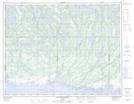
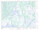
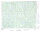
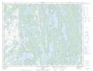
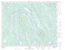
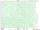
Maps showing Rivière Watshishou, Baie-Johan-Beetz; Minganie, Quebec

Rivière Watshishou is a River located in Baie-Johan-Beetz; Minganie, Quebec and has an elevation of 107 meters.

  • Latitude: 50° 16' 10'' North   (decimal: 50.2695174)
  • Longitude: 62° 41' 30'' West   (decimal: -62.6917798)
  • Topography Feature Category: River
  • Geographical Feature: Rivière
  • Canadian Province/Territory: Quebec
  • Elevation: 107 meters
  • Location: Baie-Johan-Beetz; Minganie
  • Atlas of Canada Locator Map: Rivière Watshishou
  • GPS Coordinate Locator Map: Rivière Watshishou Lat/Long

Rivière Watshishou NTS Map Sheets

012L07 Baie-Johan-Beetz Topographic Map at 1:50,000 scale

012L08 Baie Pashashibou Topographic Map at 1:50,000 scale

012L09 Lac Michaud Topographic Map at 1:50,000 scale

012L10 Lac De La Robe Noire Topographic Map at 1:50,000 scale

012L15 Lac Davy Topographic Map at 1:50,000 scale

012M02 Lac Ruffin Topographic Map at 1:50,000 scale

012L Havre-Saint-Pierre Topographic Map at 1:250,000 scale

012M Lac De Morhiban Topographic Map at 1:250,000 scale

 
Buy Topographic Maps DVD
Newsletter Sign-up

Yes, I want to receive map store discounts.


Bookmark and Share