Maps showing Rivière Wessonneau du Milieu, La Tuque; Le Haut-Saint-Maurice, Quebec
Rivière Wessonneau du Milieu is a River located in La Tuque; Le Haut-Saint-Maurice, Quebec and has an elevation of 427 meters.
- Latitude: 47° 12' 18'' North (decimal: 47.2050363)
- Longitude: 73° 1' 45'' West (decimal: -73.0292865)
- Topography Feature Category: River
- Geographical Feature: Rivière
- Canadian Province/Territory: Quebec
- Elevation: 427 meters
- Location: La Tuque; Le Haut-Saint-Maurice
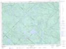
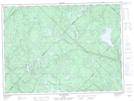
- Atlas of Canada Locator Map: Rivière Wessonneau du Milieu
- GPS Coordinate Locator Map: Rivière Wessonneau du Milieu Lat/Long
Rivière Wessonneau du Milieu NTS Map Sheets