Maps showing Rivière Wheeler, Rivière-Koksoak; Kativik, Quebec
Rivière Wheeler is a River located in Rivière-Koksoak; Kativik, Quebec.
- Latitude: 57° 4' 9'' North (decimal: 57.0693025)
- Longitude: 67° 9' 32'' West (decimal: -67.1589703)
- Topography Feature Category: River
- Geographical Feature: Rivière
- Canadian Province/Territory: Quebec
- Location: Rivière-Koksoak; Kativik
- Atlas of Canada Locator Map: Rivière Wheeler
- GPS Coordinate Locator Map: Rivière Wheeler Lat/Long
Rivière Wheeler NTS Map Sheets
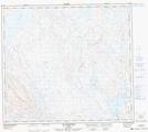
023O09 Lac Rivet Topographic Map at 1:50,000 scale
023O10 Lac Ahr Topographic Map at 1:50,000 scale
023O14 Collines Corrugated Topographic Map at 1:50,000 scale
023O15 Lac Vannes Topographic Map at 1:50,000 scale
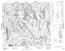
024B03 Lac Gachet Topographic Map at 1:50,000 scale
024B04 Lac Dunphy Topographic Map at 1:50,000 scale
024B05 Lac Veillard Topographic Map at 1:50,000 scale
024B11 Lac Wheeler Topographic Map at 1:50,000 scale
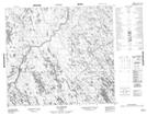
024B12 Lac Horseshoe Topographic Map at 1:50,000 scale
024B13 Lac Brissac Topographic Map at 1:50,000 scale
024B14 Lac Lhande Topographic Map at 1:50,000 scale
024B16 Lac Uzureau Topographic Map at 1:50,000 scale
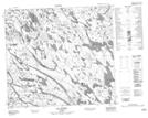
024G03 Illualutalik Topographic Map at 1:50,000 scale
023O Lac Wakuach Topographic Map at 1:250,000 scale
024B Lac Jeannin Topographic Map at 1:250,000 scale
024G Lac Saffray Topographic Map at 1:250,000 scale