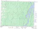
Maps showing Île Wigwam, Lac-Despinassy; Abitibi, Quebec
Île Wigwam is a Island located in Lac-Despinassy; Abitibi, Quebec and has an elevation of 315 meters.
- Latitude: 48° 40' 1'' North (decimal: 48.6669444)
- Longitude: 77° 3' 25'' West (decimal: -77.0569444)
- Topography Feature Category: Island
- Geographical Feature: Île / Ile
- Canadian Province/Territory: Quebec
- Elevation: 315 meters
- Location: Lac-Despinassy; Abitibi
- GPS Coordinate Locator Map: Île Wigwam Lat/Long
Île Wigwam NTS Map Sheets