Canada Topographic Maps

Rivière William Topo Maps

Topography maps and Latitude/Longitude Location

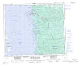
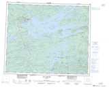
Maps showing Rivière William, Baie-James; Jamésie, Quebec

Rivière William is a River located in Baie-James; Jamésie, Quebec.

  • Latitude: 53° 55' 44'' North   (decimal: 53.9288889)
  • Longitude: 79° 0' 23'' West   (decimal: -79.0063889)
  • Topography Feature Category: River
  • Geographical Feature: Rivière
  • Canadian Province/Territory: Quebec
  • Location: Baie-James; Jamésie
  • GPS Coordinate Locator Map: Rivière William Lat/Long

Rivière William NTS Map Sheets

033E14 Stromness Island Topographic Map at 1:50,000 scale

033E15 Ile Goat Topographic Map at 1:50,000 scale

033E16 Topographic Map at 1:50,000 scale

033F13 Lac Awichina Topographic Map at 1:50,000 scale

033E Riviere Au Castor Topographic Map at 1:250,000 scale

033F Lac Sakami Topographic Map at 1:250,000 scale

 
Buy Topographic Maps DVD
Newsletter Sign-up

Yes, I want to receive map store discounts.


Bookmark and Share