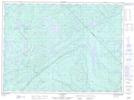
Maps showing Lac Castor, Saint-Faustin¿Lac-Carré; Les Laurentides, Quebec
Lac Castor is a Lake located in Saint-Faustin¿Lac-Carré; Les Laurentides, Quebec and has an elevation of 353 meters.
- Latitude: 46° 2' 20'' North (decimal: 46.0389334)
- Longitude: 74° 31' 41'' West (decimal: -74.5279526)
- Topography Feature Category: Lake
- Geographical Feature: Lac
- Canadian Province/Territory: Quebec
- Elevation: 353 meters
- Location: Saint-Faustin¿Lac-Carré; Les Laurentides
- Atlas of Canada Locator Map: Lac Castor
- GPS Coordinate Locator Map: Lac Castor Lat/Long
Lac Castor NTS Map Sheets