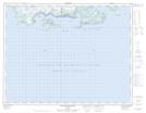
Maps showing Pointe à l'Eau Claire, Havre-Saint-Pierre; Minganie, Quebec
Pointe à l'Eau Claire is a Cape located in Havre-Saint-Pierre; Minganie, Quebec.
- Latitude: 50° 12' 12'' North (decimal: 50.2034051)
- Longitude: 63° 26' 51'' West (decimal: -63.4473623)
- Topography Feature Category: Cape
- Geographical Feature: Pointe
- Canadian Province/Territory: Quebec
- Location: Havre-Saint-Pierre; Minganie
- GPS Coordinate Locator Map: Pointe à l'Eau Claire Lat/Long
Pointe à l'Eau Claire NTS Map Sheets