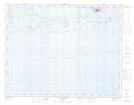
Maps showing Digue du Fantôme, Havre-Saint-Pierre; Minganie, Quebec
Digue du Fantôme is a Island located in Havre-Saint-Pierre; Minganie, Quebec and has an elevation of 0 meters.
- Latitude: 50° 14' 23'' North (decimal: 50.2397222)
- Longitude: 63° 41' 9'' West (decimal: -63.6858333)
- Topography Feature Category: Island
- Geographical Feature: Rochers
- Canadian Province/Territory: Quebec
- Elevation: 0 meters
- Location: Havre-Saint-Pierre; Minganie
- Atlas of Canada Locator Map: Digue du Fantôme
- GPS Coordinate Locator Map: Digue du Fantôme Lat/Long
Digue du Fantôme NTS Map Sheets