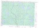
Maps showing Little Sucker Creek, Rivière-Kipawa; Témiscamingue, Quebec
Little Sucker Creek is a River located in Rivière-Kipawa; Témiscamingue, Quebec.
- Latitude: 46° 28' 18'' North (decimal: 46.4717270)
- Longitude: 77° 48' 14'' West (decimal: -77.8039196)
- Topography Feature Category: River
- Geographical Feature: Ruisseau
- Canadian Province/Territory: Quebec
- Location: Rivière-Kipawa; Témiscamingue
- GPS Coordinate Locator Map: Little Sucker Creek Lat/Long
Little Sucker Creek NTS Map Sheets