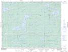
Maps showing The Loop, Baie-James; Jamésie, Quebec
The Loop is a River feature located in Baie-James; Jamésie, Quebec and has an elevation of 327 meters.
- Latitude: 49° 57' 48'' North (decimal: 49.9633333)
- Longitude: 75° 17' 00'' West (decimal: -75.2833333)
- Topography Feature Category: River feature
- Geographical Feature: Méandre
- Canadian Province/Territory: Quebec
- Elevation: 327 meters
- Location: Baie-James; Jamésie
- Atlas of Canada Locator Map: The Loop
- GPS Coordinate Locator Map: The Loop Lat/Long
The Loop NTS Map Sheets