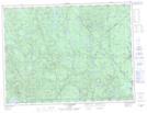
Maps showing Étangs Madelon, Lac-Ashuapmushuan; Le Domaine-du-Roy, Quebec
Étangs Madelon is a Lake located in Lac-Ashuapmushuan; Le Domaine-du-Roy, Quebec and has an elevation of 533 meters.
- Latitude: 48° 19' North (decimal: 48.3166999)
- Longitude: 72° 58' West (decimal: -72.9666999)
- Topography Feature Category: Lake
- Geographical Feature: Étangs
- Canadian Province/Territory: Quebec
- Elevation: 533 meters
- Location: Lac-Ashuapmushuan; Le Domaine-du-Roy
- Atlas of Canada Locator Map: Étangs Madelon
- GPS Coordinate Locator Map: Étangs Madelon Lat/Long
Étangs Madelon NTS Map Sheets