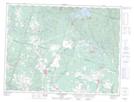
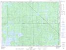
Maps showing Ruisseau Morel, Saint-Honoré; Le Fjord-du-Saguenay, Quebec
Ruisseau Morel is a River located in Saint-Honoré; Le Fjord-du-Saguenay, Quebec and has an elevation of 147 meters.
- Latitude: 48° 33' 1'' North (decimal: 48.5502778)
- Longitude: 71° 6' 43'' West (decimal: -71.1119444)
- Topography Feature Category: River
- Geographical Feature: Ruisseau
- Canadian Province/Territory: Quebec
- Elevation: 147 meters
- Location: Saint-Honoré; Le Fjord-du-Saguenay
- Atlas of Canada Locator Map: Ruisseau Morel
- GPS Coordinate Locator Map: Ruisseau Morel Lat/Long
Ruisseau Morel NTS Map Sheets