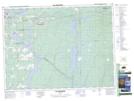
Maps showing La Natche, Rouyn-Noranda; Rouyn-Noranda, Quebec
La Natche is a Channel located in Rouyn-Noranda; Rouyn-Noranda, Quebec and has an elevation of 273 meters.
- Latitude: 48° 10' 2'' North (decimal: 48.1673090)
- Longitude: 78° 53' 12'' West (decimal: -78.8867488)
- Topography Feature Category: Channel
- Geographical Feature: Passe
- Canadian Province/Territory: Quebec
- Elevation: 273 meters
- Location: Rouyn-Noranda; Rouyn-Noranda
- Atlas of Canada Locator Map: La Natche
- GPS Coordinate Locator Map: La Natche Lat/Long
La Natche NTS Map Sheets