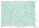
Maps showing Île des Pères-Monfortains, Rivière-Rouge; Antoine-Labelle, Quebec
Île des Pères-Monfortains is a Island located in Rivière-Rouge; Antoine-Labelle, Quebec.
- Latitude: 46° 26' 49'' North (decimal: 46.4469902)
- Longitude: 74° 45' 56'' West (decimal: -74.7654590)
- Topography Feature Category: Island
- Geographical Feature: Île / Ile
- Canadian Province/Territory: Quebec
- Location: Rivière-Rouge; Antoine-Labelle
- GPS Coordinate Locator Map: Île des Pères-Monfortains Lat/Long
Île des Pères-Monfortains NTS Map Sheets