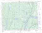
Maps showing Le Petit Havre, Sept-Îles; Sept-Rivières, Quebec
Le Petit Havre is a Bay located in Sept-Îles; Sept-Rivières, Quebec and has an elevation of 12 meters.
- Latitude: 50° 8' 35'' North (decimal: 50.1431078)
- Longitude: 66° 31' 16'' West (decimal: -66.5210608)
- Topography Feature Category: Bay
- Geographical Feature: Havre
- Canadian Province/Territory: Quebec
- Elevation: 12 meters
- Location: Sept-Îles; Sept-Rivières
- Atlas of Canada Locator Map: Le Petit Havre
- GPS Coordinate Locator Map: Le Petit Havre Lat/Long
Le Petit Havre NTS Map Sheets