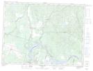
Maps showing Lac Castor, Sainte-Jeanne-d'Arc; Maria-Chapdelaine, Quebec
Lac Castor is a Lake located in Sainte-Jeanne-d'Arc; Maria-Chapdelaine, Quebec and has an elevation of 202 meters.
- Latitude: 48° 56' 47'' North (decimal: 48.9463889)
- Longitude: 71° 59' 45'' West (decimal: -71.9958333)
- Topography Feature Category: Lake
- Geographical Feature: Lac
- Canadian Province/Territory: Quebec
- Elevation: 202 meters
- Location: Sainte-Jeanne-d'Arc; Maria-Chapdelaine
- Atlas of Canada Locator Map: Lac Castor
- GPS Coordinate Locator Map: Lac Castor Lat/Long
Lac Castor NTS Map Sheets