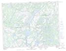
Maps showing Lac à Fanny, Cap-Saint-Ignace; Montmagny, Quebec
Lac à Fanny is a Lake located in Cap-Saint-Ignace; Montmagny, Quebec and has an elevation of 176 meters.
- Latitude: 47° 0' 27'' North (decimal: 47.0075220)
- Longitude: 70° 23' 23'' West (decimal: -70.3897950)
- Topography Feature Category: Lake
- Geographical Feature: Lac
- Canadian Province/Territory: Quebec
- Elevation: 176 meters
- Location: Cap-Saint-Ignace; Montmagny
- Atlas of Canada Locator Map: Lac à Fanny
- GPS Coordinate Locator Map: Lac à Fanny Lat/Long
Lac à Fanny NTS Map Sheets