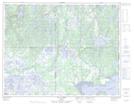
Maps showing La Table, Havre-Saint-Pierre; Minganie, Quebec
La Table is a Mountain located in Havre-Saint-Pierre; Minganie, Quebec.
- Latitude: 50° 17' 41'' North (decimal: 50.2947222)
- Longitude: 63° 5' 25'' West (decimal: -63.0902778)
- Topography Feature Category: Mountain
- Geographical Feature: Mont
- Canadian Province/Territory: Quebec
- Location: Havre-Saint-Pierre; Minganie
- GPS Coordinate Locator Map: La Table Lat/Long
La Table NTS Map Sheets