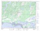
Maps showing Rivière des Caps Blancs, Havre-Saint-Pierre; Minganie, Quebec
Rivière des Caps Blancs is a River located in Havre-Saint-Pierre; Minganie, Quebec.
- Latitude: 50° 15' 12'' North (decimal: 50.2533333)
- Longitude: 63° 33' 48'' West (decimal: -63.5633333)
- Topography Feature Category: River
- Geographical Feature: Ruisseau
- Canadian Province/Territory: Quebec
- Location: Havre-Saint-Pierre; Minganie
- GPS Coordinate Locator Map: Rivière des Caps Blancs Lat/Long
Rivière des Caps Blancs NTS Map Sheets