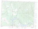
Maps showing Étang des Mélèzes, Sainte-Jeanne-d'Arc; Maria-Chapdelaine, Quebec
Étang des Mélèzes is a Lake located in Sainte-Jeanne-d'Arc; Maria-Chapdelaine, Quebec and has an elevation of 261 meters.
- Latitude: 48° 59' 42'' North (decimal: 48.995)
- Longitude: 71° 53' 42'' West (decimal: -71.8949999)
- Topography Feature Category: Lake
- Geographical Feature: Étang
- Canadian Province/Territory: Quebec
- Elevation: 261 meters
- Location: Sainte-Jeanne-d'Arc; Maria-Chapdelaine
- Atlas of Canada Locator Map: Étang des Mélèzes
- GPS Coordinate Locator Map: Étang des Mélèzes Lat/Long
Étang des Mélèzes NTS Map Sheets