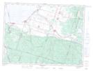
Maps showing Pointe-du-Lac, Saint-Gédéon; Lac-Saint-Jean-Est, Quebec
Pointe-du-Lac is a Unincorporated area located in Saint-Gédéon; Lac-Saint-Jean-Est, Quebec and has an elevation of 100 meters.
- Latitude: 48° 30' 7'' North (decimal: 48.5019444)
- Longitude: 71° 46' 54'' West (decimal: -71.7816667)
- Topography Feature Category: Unincorporated area
- Geographical Feature: Centre de villégiature
- Canadian Province/Territory: Quebec
- Elevation: 100 meters
- Location: Saint-Gédéon; Lac-Saint-Jean-Est
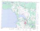
- Atlas of Canada Locator Map: Pointe-du-Lac
- GPS Coordinate Locator Map: Pointe-du-Lac Lat/Long
Pointe-du-Lac NTS Map Sheets