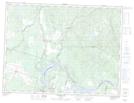
Maps showing Lac Ceinture, Saint-Augustin; Maria-Chapdelaine, Quebec
Lac Ceinture is a Lake located in Saint-Augustin; Maria-Chapdelaine, Quebec and has an elevation of 190 meters.
- Latitude: 48° 51' 29'' North (decimal: 48.8580556)
- Longitude: 71° 55' 10'' West (decimal: -71.9194444)
- Topography Feature Category: Lake
- Geographical Feature: Lac
- Canadian Province/Territory: Quebec
- Elevation: 190 meters
- Location: Saint-Augustin; Maria-Chapdelaine
- Atlas of Canada Locator Map: Lac Ceinture
- GPS Coordinate Locator Map: Lac Ceinture Lat/Long
Lac Ceinture NTS Map Sheets