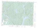
Maps showing Baie du Banc de Sable, Chute-des-Passes; Maria-Chapdelaine, Quebec
Baie du Banc de Sable is a Bay located in Chute-des-Passes; Maria-Chapdelaine, Quebec and has an elevation of 174 meters.
- Latitude: 48° 53' 28'' North (decimal: 48.8911111)
- Longitude: 71° 27' 9'' West (decimal: -71.4525)
- Topography Feature Category: Bay
- Geographical Feature: Baie
- Canadian Province/Territory: Quebec
- Elevation: 174 meters
- Location: Chute-des-Passes; Maria-Chapdelaine
- Atlas of Canada Locator Map: Baie du Banc de Sable
- GPS Coordinate Locator Map: Baie du Banc de Sable Lat/Long
Baie du Banc de Sable NTS Map Sheets