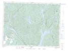
Maps showing Baie de Foin, Lamarche; Lac-Saint-Jean-Est, Quebec
Baie de Foin is a Bay located in Lamarche; Lac-Saint-Jean-Est, Quebec and has an elevation of 169 meters.
- Latitude: 48° 46' 50'' North (decimal: 48.7805556)
- Longitude: 71° 29' 26'' West (decimal: -71.4905556)
- Topography Feature Category: Bay
- Geographical Feature: Baie
- Canadian Province/Territory: Quebec
- Elevation: 169 meters
- Location: Lamarche; Lac-Saint-Jean-Est
- Atlas of Canada Locator Map: Baie de Foin
- GPS Coordinate Locator Map: Baie de Foin Lat/Long
Baie de Foin NTS Map Sheets