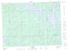
Maps showing Ruisseau Boulder, Rivière-Kipawa; Témiscamingue, Quebec
Ruisseau Boulder is a River located in Rivière-Kipawa; Témiscamingue, Quebec.
- Latitude: 47° 32' 41'' North (decimal: 47.5447954)
- Longitude: 78° 19' 1'' West (decimal: -78.3170035)
- Topography Feature Category: River
- Geographical Feature: Ruisseau
- Canadian Province/Territory: Quebec
- Location: Rivière-Kipawa; Témiscamingue
- Atlas of Canada Locator Map: Ruisseau Boulder
- GPS Coordinate Locator Map: Ruisseau Boulder Lat/Long
Ruisseau Boulder NTS Map Sheets