Maps showing Crique Hébert, Rivière-aux-Outardes; Manicouagan, Quebec
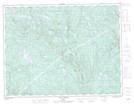
Crique Hébert is a River located in Rivière-aux-Outardes; Manicouagan, Quebec and has an elevation of 196 meters.
- Latitude: 49° 31' 36'' North (decimal: 49.5267129)
- Longitude: 67° 29' 36'' West (decimal: -67.4933293)
- Topography Feature Category: River
- Geographical Feature: Ruisseau
- Canadian Province/Territory: Quebec
- Elevation: 196 meters
- Location: Rivière-aux-Outardes; Manicouagan
- Atlas of Canada Locator Map: Crique Hébert
- GPS Coordinate Locator Map: Crique Hébert Lat/Long
Crique Hébert NTS Map Sheets