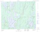
Maps showing Rivière-Chalifour, Baie-James; Jamésie, Quebec
Rivière-Chalifour is a Unincorporated area located in Baie-James; Jamésie, Quebec.
- Latitude: 50° 24' 13'' North (decimal: 50.4036111)
- Longitude: 73° 40' 54'' West (decimal: -73.6816666)
- Topography Feature Category: Unincorporated area
- Geographical Feature: Lieu-dit
- Canadian Province/Territory: Quebec
- Location: Baie-James; Jamésie
- Atlas of Canada Locator Map: Rivière-Chalifour
- GPS Coordinate Locator Map: Rivière-Chalifour Lat/Long
Rivière-Chalifour NTS Map Sheets