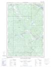
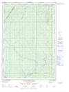
Maps showing Ruisseau Pockwock Branche Ouest, Picard; Kamouraska, Quebec
Ruisseau Pockwock Branche Ouest is a River located in Picard; Kamouraska, Quebec and has an elevation of 540 meters.
- Latitude: 47° 13' 0'' North (decimal: 47.2166874)
- Longitude: 69° 28' 23'' West (decimal: -69.4731045)
- Topography Feature Category: River
- Geographical Feature: Ruisseau
- Canadian Province/Territory: Quebec
- Elevation: 540 meters
- Location: Picard; Kamouraska
- Atlas of Canada Locator Map: Ruisseau Pockwock Branche Ouest
- GPS Coordinate Locator Map: Ruisseau Pockwock Branche Ouest Lat/Long
Ruisseau Pockwock Branche Ouest NTS Map Sheets