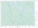
Maps showing Lac Bent, Baie-de-la-Bouteille; Matawinie, Quebec
Lac Bent is a Lake located in Baie-de-la-Bouteille; Matawinie, Quebec and has an elevation of 580 meters.
- Latitude: 47° 2' 32'' North (decimal: 47.0422730)
- Longitude: 74° 15' 53'' West (decimal: -74.2645957)
- Topography Feature Category: Lake
- Geographical Feature: Lac
- Canadian Province/Territory: Quebec
- Elevation: 580 meters
- Location: Baie-de-la-Bouteille; Matawinie
- GPS Coordinate Locator Map: Lac Bent Lat/Long
Lac Bent NTS Map Sheets