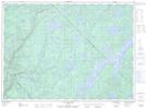
Maps showing Ruisseau Lavoie, Lac-De La Bidière; Antoine-Labelle, Quebec
Ruisseau Lavoie is a River located in Lac-De La Bidière; Antoine-Labelle, Quebec.
- Latitude: 47° 23' 13'' North (decimal: 47.3870083)
- Longitude: 75° 6' 53'' West (decimal: -75.1146121)
- Topography Feature Category: River
- Geographical Feature: Ruisseau
- Canadian Province/Territory: Quebec
- Location: Lac-De La Bidière; Antoine-Labelle
- Atlas of Canada Locator Map: Ruisseau Lavoie
- GPS Coordinate Locator Map: Ruisseau Lavoie Lat/Long
Ruisseau Lavoie NTS Map Sheets