Maps showing Lac à Foin, Baie-Obaoca; Matawinie, Quebec
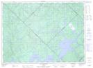
Lac à Foin is a Lake located in Baie-Obaoca; Matawinie, Quebec.
- Latitude: 47° 34' 38'' North (decimal: 47.5772222)
- Longitude: 74° 14' 42'' West (decimal: -74.245)
- Topography Feature Category: Lake
- Geographical Feature: Lac
- Canadian Province/Territory: Quebec
- Location: Baie-Obaoca; Matawinie
- Atlas of Canada Locator Map: Lac à Foin
- GPS Coordinate Locator Map: Lac à Foin Lat/Long
Lac à Foin NTS Map Sheets