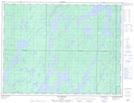
Maps showing Passe Mesplet, Senneterre; Vallée-de-l'Or, Quebec
Passe Mesplet is a Channel located in Senneterre; Vallée-de-l'Or, Quebec and has an elevation of 395 meters.
- Latitude: 48° 45' 34'' North (decimal: 48.7595178)
- Longitude: 75° 46' 00'' West (decimal: -75.7665710)
- Topography Feature Category: Channel
- Geographical Feature: Passe
- Canadian Province/Territory: Quebec
- Elevation: 395 meters
- Location: Senneterre; Vallée-de-l'Or
- Atlas of Canada Locator Map: Passe Mesplet
- GPS Coordinate Locator Map: Passe Mesplet Lat/Long
Passe Mesplet NTS Map Sheets