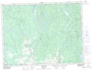
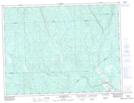
Maps showing Rivière Phiran, Notre-Dame-de-Lorette; Maria-Chapdelaine, Quebec
Rivière Phiran is a River located in Notre-Dame-de-Lorette; Maria-Chapdelaine, Quebec and has an elevation of 182 meters.
- Latitude: 49° 2' 17'' North (decimal: 49.0380705)
- Longitude: 72° 29' 53'' West (decimal: -72.4980684)
- Topography Feature Category: River
- Geographical Feature: Rivière
- Canadian Province/Territory: Quebec
- Elevation: 182 meters
- Location: Notre-Dame-de-Lorette; Maria-Chapdelaine
- Atlas of Canada Locator Map: Rivière Phiran
- GPS Coordinate Locator Map: Rivière Phiran Lat/Long
Rivière Phiran NTS Map Sheets