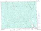
Maps showing Lac Brochet, Saint-Thomas-Didyme; Maria-Chapdelaine, Quebec
Lac Brochet is a Lake located in Saint-Thomas-Didyme; Maria-Chapdelaine, Quebec and has an elevation of 242 meters.
- Latitude: 49° 0' 14'' North (decimal: 49.0039200)
- Longitude: 72° 42' 32'' West (decimal: -72.7089605)
- Topography Feature Category: Lake
- Geographical Feature: Lac
- Canadian Province/Territory: Quebec
- Elevation: 242 meters
- Location: Saint-Thomas-Didyme; Maria-Chapdelaine
- Atlas of Canada Locator Map: Lac Brochet
- GPS Coordinate Locator Map: Lac Brochet Lat/Long
Lac Brochet NTS Map Sheets