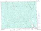
Maps showing Lac à l'Ours, Saint-Edmond; Maria-Chapdelaine, Quebec
Lac à l'Ours is a Lake located in Saint-Edmond; Maria-Chapdelaine, Quebec and has an elevation of 239 meters.
- Latitude: 49° 0' 44'' North (decimal: 49.0122222)
- Longitude: 72° 38' 53'' West (decimal: -72.6480556)
- Topography Feature Category: Lake
- Geographical Feature: Lac
- Canadian Province/Territory: Quebec
- Elevation: 239 meters
- Location: Saint-Edmond; Maria-Chapdelaine
- Atlas of Canada Locator Map: Lac à l'Ours
- GPS Coordinate Locator Map: Lac à l'Ours Lat/Long
Lac à l'Ours NTS Map Sheets