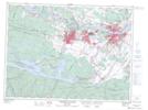
Maps showing Lac des Cônes, Saguenay; Saguenay, Quebec
Lac des Cônes is a Lake located in Saguenay; Saguenay, Quebec and has an elevation of 181 meters.
- Latitude: 48° 24' 16'' North (decimal: 48.4044444)
- Longitude: 71° 20' 41'' West (decimal: -71.3447222)
- Topography Feature Category: Lake
- Geographical Feature: Lac
- Canadian Province/Territory: Quebec
- Elevation: 181 meters
- Location: Saguenay; Saguenay
- Atlas of Canada Locator Map: Lac des Cônes
- GPS Coordinate Locator Map: Lac des Cônes Lat/Long
Lac des Cônes NTS Map Sheets