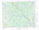
Maps showing Rivière Dumais, Lac-Walker; Sept-Rivières, Quebec
Rivière Dumais is a River located in Lac-Walker; Sept-Rivières, Quebec and has an elevation of 150 meters.
- Latitude: 50° 34' 50'' North (decimal: 50.5805931)
- Longitude: 66° 36' 33'' West (decimal: -66.6090811)
- Topography Feature Category: River
- Geographical Feature: Rivière
- Canadian Province/Territory: Quebec
- Elevation: 150 meters
- Location: Lac-Walker; Sept-Rivières
- Atlas of Canada Locator Map: Rivière Dumais
- GPS Coordinate Locator Map: Rivière Dumais Lat/Long
Rivière Dumais NTS Map Sheets