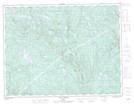
Maps showing Ruisseau Fafard, Port-Cartier; Sept-Rivières, Quebec
Ruisseau Fafard is a River located in Port-Cartier; Sept-Rivières, Quebec and has an elevation of 218 meters.
- Latitude: 49° 37' 50'' North (decimal: 49.6306022)
- Longitude: 67° 29' 19'' West (decimal: -67.4885957)
- Topography Feature Category: River
- Geographical Feature: Ruisseau
- Canadian Province/Territory: Quebec
- Elevation: 218 meters
- Location: Port-Cartier; Sept-Rivières
- Atlas of Canada Locator Map: Ruisseau Fafard
- GPS Coordinate Locator Map: Ruisseau Fafard Lat/Long
Ruisseau Fafard NTS Map Sheets