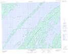
Maps showing Île Tchapahipane, Baie-James; Jamésie, Quebec
Île Tchapahipane is a Island located in Baie-James; Jamésie, Quebec and has an elevation of 394 meters.
- Latitude: 51° 7' 35'' North (decimal: 51.1263889)
- Longitude: 73° 20' 50'' West (decimal: -73.3472222)
- Topography Feature Category: Island
- Geographical Feature: Île / Ile
- Canadian Province/Territory: Quebec
- Elevation: 394 meters
- Location: Baie-James; Jamésie
- Atlas of Canada Locator Map: Île Tchapahipane
- GPS Coordinate Locator Map: Île Tchapahipane Lat/Long
Île Tchapahipane NTS Map Sheets