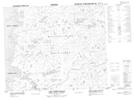
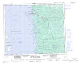
Maps showing Rivière Maugras, Baie-James; Jamésie, Quebec
Rivière Maugras is a River located in Baie-James; Jamésie, Quebec.
- Latitude: 53° 8' 55'' North (decimal: 53.1486111)
- Longitude: 78° 56' 8'' West (decimal: -78.9355556)
- Topography Feature Category: River
- Geographical Feature: Rivière
- Canadian Province/Territory: Quebec
- Location: Baie-James; Jamésie
- Atlas of Canada Locator Map: Rivière Maugras
- GPS Coordinate Locator Map: Rivière Maugras Lat/Long
Rivière Maugras NTS Map Sheets