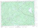
Maps showing Lac Baxter, Lac-Normand; Mékinac, Quebec
Lac Baxter is a Lake located in Lac-Normand; Mékinac, Quebec and has an elevation of 321 meters.
- Latitude: 47° 25' 42'' North (decimal: 47.4283733)
- Longitude: 73° 5' 41'' West (decimal: -73.0948377)
- Topography Feature Category: Lake
- Geographical Feature: Lac
- Canadian Province/Territory: Quebec
- Elevation: 321 meters
- Location: Lac-Normand; Mékinac
- Atlas of Canada Locator Map: Lac Baxter
- GPS Coordinate Locator Map: Lac Baxter Lat/Long
Lac Baxter NTS Map Sheets