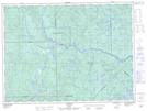
Maps showing Lac Caché, LaTuque; Le Haut-Saint-Maurice, Quebec
Lac Caché is a Lake located in LaTuque; Le Haut-Saint-Maurice, Quebec.
- Latitude: 47° 47' 55'' North (decimal: 47.7986111)
- Longitude: 73° 30' 57'' West (decimal: -73.5158333)
- Topography Feature Category: Lake
- Geographical Feature: Lac
- Canadian Province/Territory: Quebec
- Location: LaTuque; Le Haut-Saint-Maurice
- GPS Coordinate Locator Map: Lac Caché Lat/Long