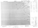
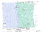
Maps showing Île Astichikun, Baie-James; Jamésie, Quebec
Île Astichikun is a Island located in Baie-James; Jamésie, Quebec.
- Latitude: 53° 24' 37'' North (decimal: 53.4102778)
- Longitude: 79° 0' 41'' West (decimal: -79.0113889)
- Topography Feature Category: Island
- Geographical Feature: Île / Ile
- Canadian Province/Territory: Quebec
- Location: Baie-James; Jamésie
- Atlas of Canada Locator Map: Île Astichikun
- GPS Coordinate Locator Map: Île Astichikun Lat/Long