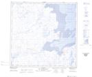
Maps showing Îlot Coffin, Rivière-Koksoak; Kativik, Quebec
Îlot Coffin is a Island located in Rivière-Koksoak; Kativik, Quebec and has an elevation of 0 meters.
- Latitude: 59° 22' 21'' North (decimal: 59.3724284)
- Longitude: 69° 34' 12'' West (decimal: -69.5700931)
- Topography Feature Category: Island
- Geographical Feature: Îlot / Ilot
- Canadian Province/Territory: Quebec
- Elevation: 0 meters
- Location: Rivière-Koksoak; Kativik
- Atlas of Canada Locator Map: Îlot Coffin
- GPS Coordinate Locator Map: Îlot Coffin Lat/Long
Îlot Coffin NTS Map Sheets