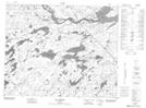
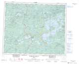
Maps showing Les Mélèzes, Baie-James; Jamésie, Quebec
Les Mélèzes is a Unincorporated area located in Baie-James; Jamésie, Quebec and has an elevation of 210 meters.
- Latitude: 52° 13' 13'' North (decimal: 52.2203805)
- Longitude: 76° 37' 13'' West (decimal: -76.6202798)
- Topography Feature Category: Unincorporated area
- Geographical Feature: Lieu-dit
- Canadian Province/Territory: Quebec
- Elevation: 210 meters
- Location: Baie-James; Jamésie
- Atlas of Canada Locator Map: Les Mélèzes
- GPS Coordinate Locator Map: Les Mélèzes Lat/Long
Les Mélèzes NTS Map Sheets