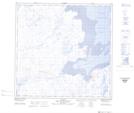
Maps showing Baie Nikuttiviup Paanga, Rivière-Koksoak; Kativik, Quebec
Baie Nikuttiviup Paanga is a Bay located in Rivière-Koksoak; Kativik, Quebec.
- Latitude: 59° 23' 28'' North (decimal: 59.3910399)
- Longitude: 69° 38' 55'' West (decimal: -69.6487056)
- Topography Feature Category: Bay
- Geographical Feature: Baie
- Canadian Province/Territory: Quebec
- Location: Rivière-Koksoak; Kativik
- Atlas of Canada Locator Map: Baie Nikuttiviup Paanga
- GPS Coordinate Locator Map: Baie Nikuttiviup Paanga Lat/Long
Baie Nikuttiviup Paanga NTS Map Sheets