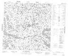
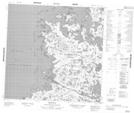
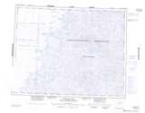
Maps showing Île Qikirtaaluk, Baie-d'Hudson; Kativik, Quebec
Île Qikirtaaluk is a Island located in Baie-d'Hudson; Kativik, Quebec.
- Latitude: 59° 38' 51'' North (decimal: 59.6475)
- Longitude: 77° 30' 2'' West (decimal: -77.5005556)
- Topography Feature Category: Island
- Geographical Feature: Île / Ile
- Canadian Province/Territory: Quebec
- Location: Baie-d'Hudson; Kativik
- Atlas of Canada Locator Map: Île Qikirtaaluk
- GPS Coordinate Locator Map: Île Qikirtaaluk Lat/Long
Île Qikirtaaluk NTS Map Sheets